Greina Plateau: Graubünden & Ticino
The Greina Plateau is a spectacular high-altitude tundra that lies between cantons Graubünden and Ticino. It’s hard to perceive it’s vastness through photos - you really need to see it for yourself.
I had this area on my hiking bucket list for years, and it exceeded my expectations. The Greina itself is definitely the most anticipated highlight, but the entire trail is beautifully varied. There were many, many highlights over the course of two days (note: while it’s possible as a very long day hike, I think it’s best experienced with a hut overnight). One of the coolest parts, I think, is starting in one Swiss canton and ending in another. We hiked from Val Lumezia in Graubünden to Val Camadra in Ticino, with an overnight in the Terrihutte. And even though the weather forecast was not promising in the days leading up to our trek, we got incredibly lucky and didn’t even have to use rain jackets once! Pure Greina magic.
Day 1
Our journey started in Vrin, a small village in Graubünden. We hiked along the river through the Val Lumezia, gradually gaining elevation until Puzzatsch. I’ll note here that there is an alpine bus that runs from Vrin to Puzzatsch that you can reserve (which would be useful if you are attempting the day hike version). Things start getting steep after that - it’s a pretty relentless climb all the way up to Pass Diesrut, the highest point of day one, but the views just keep getting better and better!
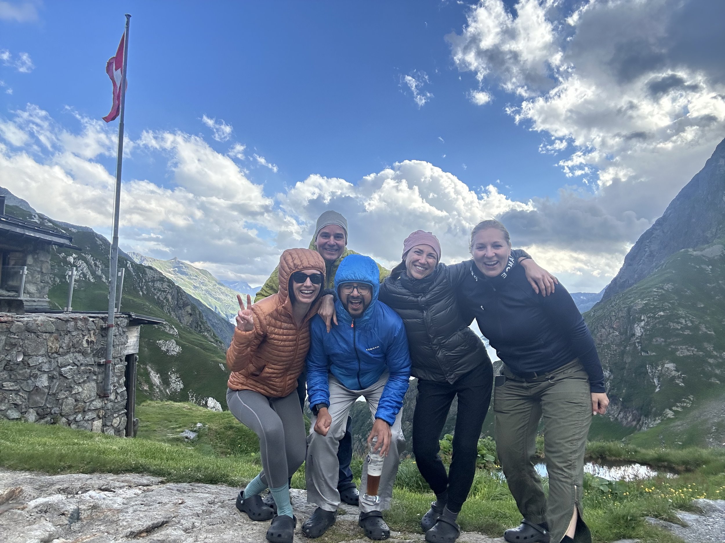
After the pass, the trail zigzags downhill toward the plateau (a sneak preview of tomorrow!) and, in the distance, the Terrihutte. There’s really nothing better than finally laying eyes on the hut after a long day of hiking - even if it seems farther away than you want it to be! We all crossed the suspension bridge, a short but exciting bridge over the Sumvitg river, and continued along the hut trail that runs alongside the gorge. There are chains along this part, but it doesn’t feel that exposed and they aren’t that necessary (in my opinion). And then, we arrived at one of the most beautifully situated huts I’ve been to in Switzerland. Terrihutte (or Camona da Terri, in Romanesque) is a stone hut perched on a small mountain top at the intersection between three different valleys, surrounded by high Greina peaks. It has lovely wardens, cozy rooms, and a huge terrace. Highly recommend!
Start: Vrin, vtig
End: Campo Blenio
Basic Route: Vrin - Puzzatsch - Pass Diesrut - Terri
11.5km, 1130m ascent/440m descent, T2


Day 2

If you thought day one was magical, just wait for day two. This is where things really pick up in terms of unique and dramatic landscape.
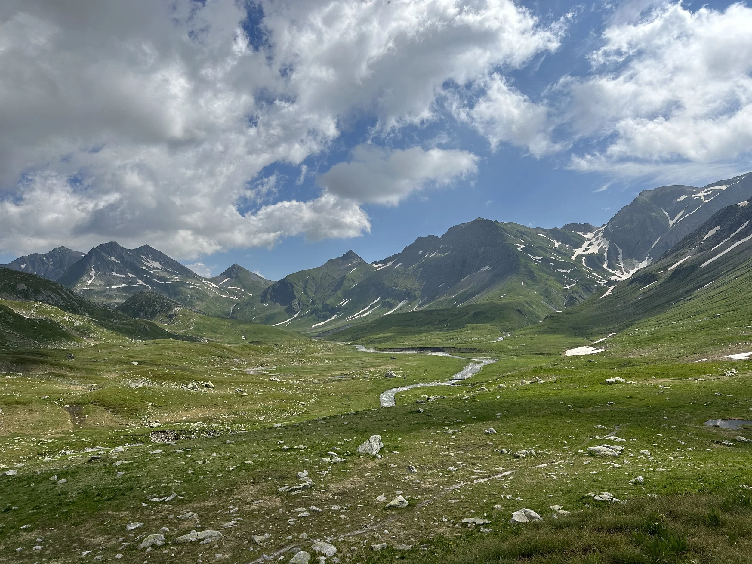
We backtracked a bit from the hut, back over the suspension bridge, so we could walk the plateau in it’s entirety. The Greina plateau itself is six kilometers long and one kilometer wide, and it’s impossible to portray the sheer vastness in photos. Glacial blue rivers and streams meander through the valley, creating a type of high-altitude floodplain. We took our time hiking through. Our friends thought it looked like New Zealand, but greener. It was one of the most beautiful areas I’ve been to, in Switzerland or otherwise. Honestly, I had been a little worried that I would be slightly underwhelmed, based on photos I had seen, but let me tell you - photos don’t do it justice. I had the goofiest grin on my face.
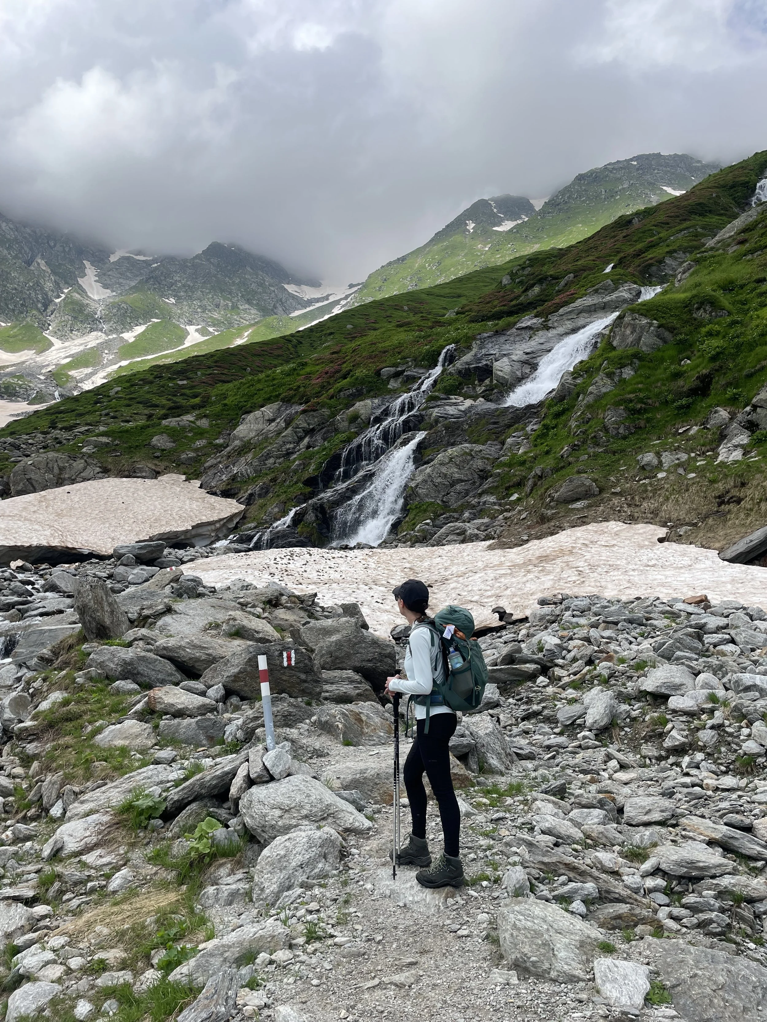
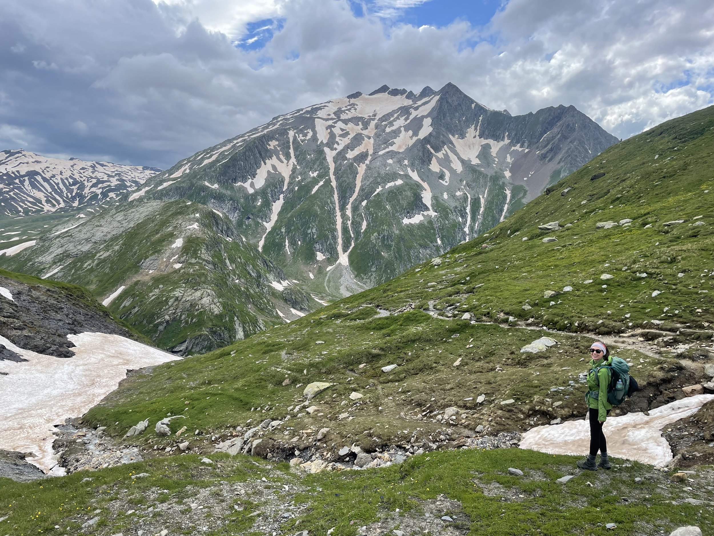
After the plateau, there is a bit more climbing to the Passo della Greina, when you pass the cantonal border into Ticino (you’ll noticed the buongiorno!). There was quite a bit of snow lingering in mid-July, but nothing unmanageable. The landscape changes dramatically and surprisingly quickly, from lush tundra and green mountains to rocky Ticinese peaks. We stopped at Capanna Scaletta for lunch, before the grueling (but stunning!) three-hour descent to Campo Blenio. As tough as the descent was on the knees, the many waterfalls and deep views into the storybook Val Camadra made it all worth it.
Start: Terrihutte
End: Campo Blenio
Basic Route: Terrihutte - Hangbrucke - Plaun la Greina - Passo della Greina - Capanna Scaletta - Blenio
18km, 450m ascent/ 1400m descent, T2