Summer Wanderweg: Favorite Hiking Trails of 2024
No, you didn’t hallucinate.
I completely skipped blogging about summer 2023 hikes. Which is a shame, since it was a great season! I swear I’ll get to those eventually. But to avoid getting backed up even further, I’m starting my 2024 post. Here’s hoping I will get back on schedule soon.
Alas - summer 2024, weather-wise, is not off to a great start. Climate change + the absolutely unforgivable decision to cancel the Böögg burning for the first time in Zürich’s history (sure, burning it in a violent wind storm would have been a literal fire hazard…but, look at the cost we have paid!) has created rainy, stormy, and sometimes scary mountain conditions this year. But nevertheless, we persist.
As always, I’ll be adding to this post as I go.

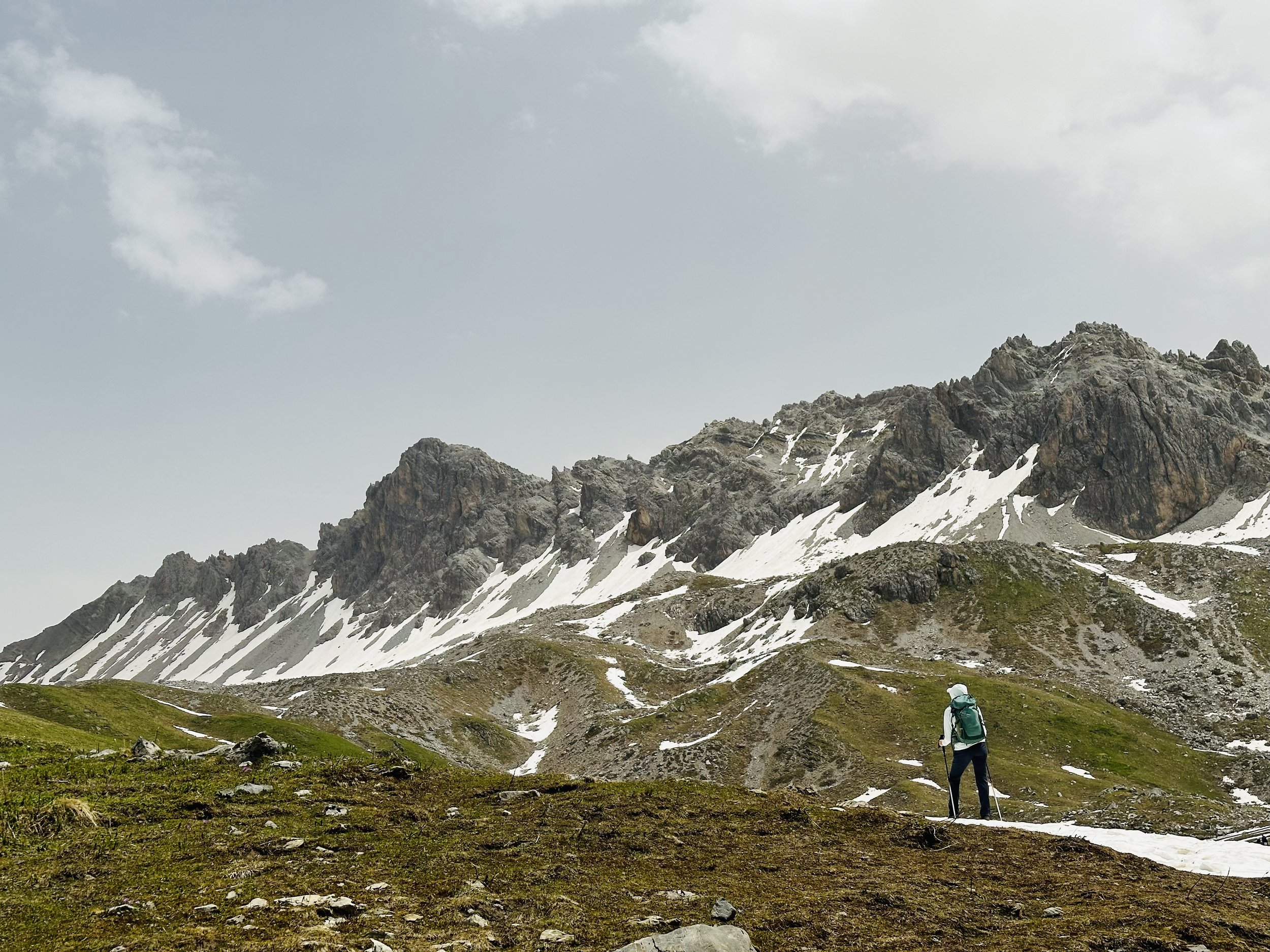
The Greina Plateau is a spectacular high-altitude tundra that lies between cantons Graubünden and Ticino. It’s hard to perceive it’s vastness through photos - you really need to see it for yourself. The Greina itself is definitely the most anticipated highlight, but the entire trail is beautifully varied. There were many, many highlights over the course of two days (note: while it’s possible as a very long day hike, I think it’s best experienced with a hut overnight).
Chüebodensee and Wildmaad: Glarus (Elm)

The circular hike from Ampachli to Chüebodensee is a gem. It’s a short yet sporty climb, but once you reach the lake, nestled in its little mountain basin, surrounded by green slopes and jagged peaks, all the sweat is (mostly) forgotten. For extra points, and even more views of all the Glarus Alps, add the detour up to Wildmaad plateau and the Wildmaadfurggeli viewpoint.
Start/End: Elm (Ampachli mountain station)
Basic Route: Ampachli - Chüeboden - Chüebodensee - Wildmaadfurggeli - Ampachli
10.5 km, 865m ascent/descent, T2
Capanna del Forno: Graubünden
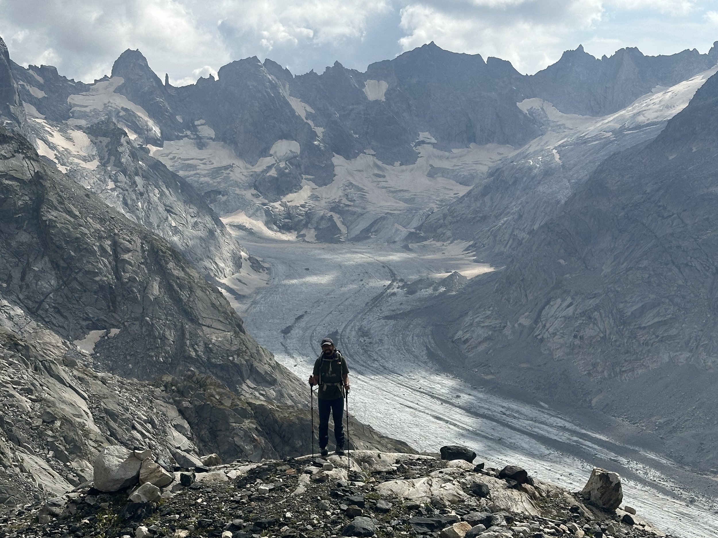
The Capanna del Forno is perched above a stunning glacier, right on the Italian border. It’s epic location and fun trail make it one of my favorite hut weekends to date! There are two main approaches to Capanna del Forno - a high trail and a valley trail - that can be combined into a loop. Both trails are quite different in terms of view and terrain, so you really get a feel for the whole area. And no matter which way you choose, you’ll pass the pretty Lägh da Cavloc, which has a restaurant that makes a perfect lunch stop on your second day.
Klontarlersee to Gumensattel: Glarus

I’m not going to sugarcoat it: this one will make you suffer.
Klöntalersee is easily, easily, one of the most beautiful lakes in Switzerland. Seeing it from above, a fjord-like turquoise lake surrounded by sheer mountains, is an absolute treat. Getting there, unfortunately, is not a treat. When I read about this trail, it was referred to as an “insider tip,” because you’ll likely see few other hikers. Now I know the real reason: it’s a sufferfest. But a beautiful one!
Start/End: Rhodannenberg
Basic Route: Rhodannenberg - Auerenalp - Gumensattel - Dejen - Rhodannenberg
11km, 1330m ascent/descent. T2/T3
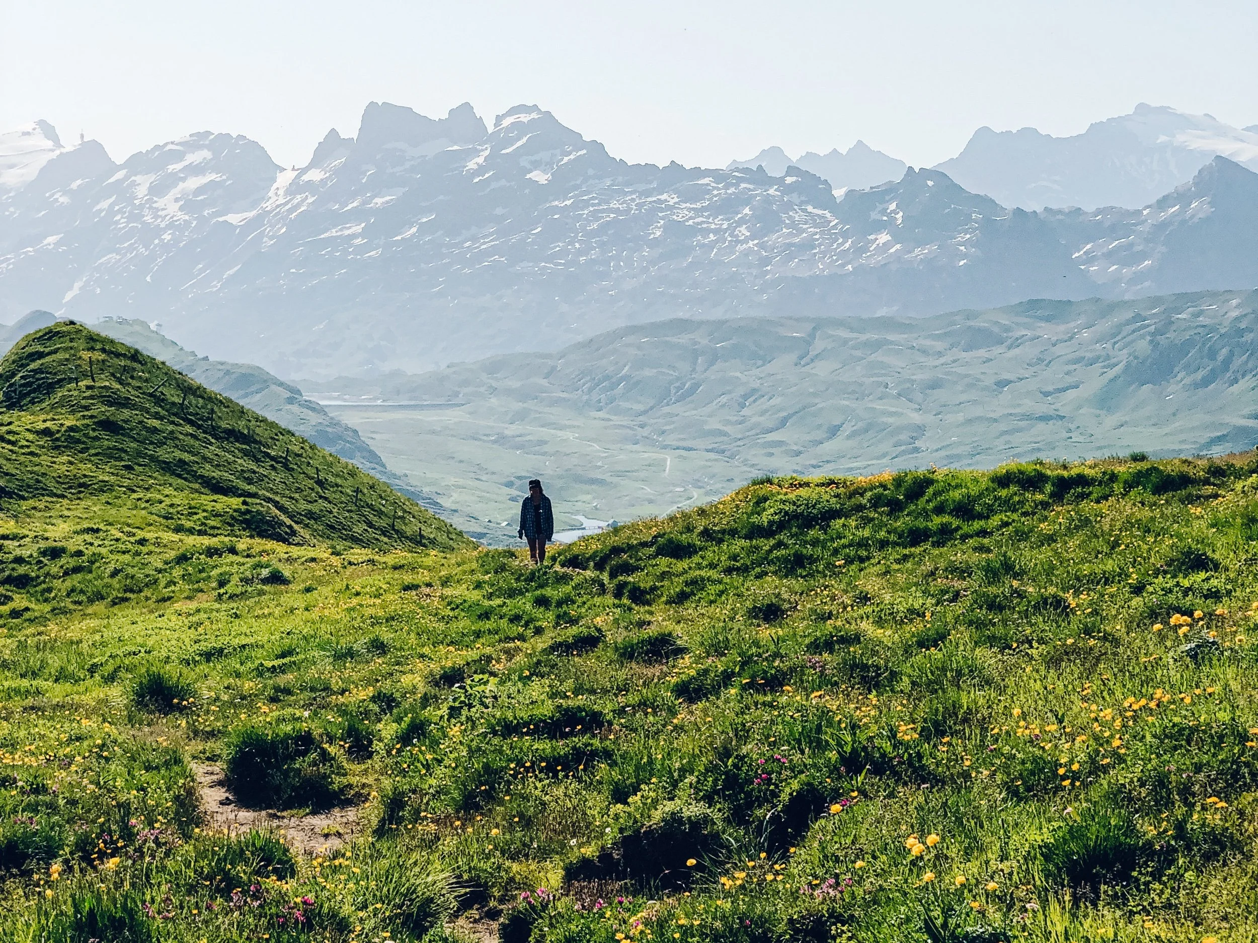
Ducantal/Walserweg: Graubünden
This hike was the perfect season-opener: a nice climb through meadows and forests full of wildflowers to a high mountain plateau, a descent down through the long Ducantal, and ending strong with a massive three-tiered waterfall.
Start: Davos Monstein
End: Sertig Dörfli
Basic Route: Monstein - Fanezmeder - Fanezfurgga - Ducantal - Wasserfall - Sertig Dörfli
15km, 1284m ascent/768m descent, T2
Chamanna Jenatsch: Graubünden

One of the most unique hikes I’ve done in Switzerland! Expect an explosion of color: from the rocks, the mountains, the lakes, the rivers, the valleys - everything is vibrant in one way or another. This hike is long and beautifully varied, with the landscapes changing drastically throughout the 22 kilometers. The halfway point is the charming Chamanna Jenatsch, the highest SAC hut in Graubunden.
Start: Julier Pass (La Veduta)
End: Spinas
Basic Route: Julier Pass - Fuorcla d'Agnel - Jenatschütte - Tegia d'Val - Spinas
22km, 985m ascent/1400m descent, T3 (approach)/T2 (descent)
Gelmersee and Gelmerhütte: Berner Oberland

Switzerland has no shortage of turquoise alpine lakes, but the Gelmersee might be a new favorite. This is a popular area, namely because of the Insta-famous Gelmerbahn (the “Swiss roller coaster”), but you don’t need the funicular to get to this seriously stunning lake. There is a fun trail from the valley up to Gelmersee, that then continues up to the Gelmer Hut. Bonus points if you are brave enough for an icy cold swim on your way back down.
Start/End: Handegg, Kunzentännlein
Basic Route: Kunzentännlein - Gelmersee - Gelmerhutte - Gelmersee - Kunzentännlein
11km, 940m ascent/descent, 5 hours, T2/T3
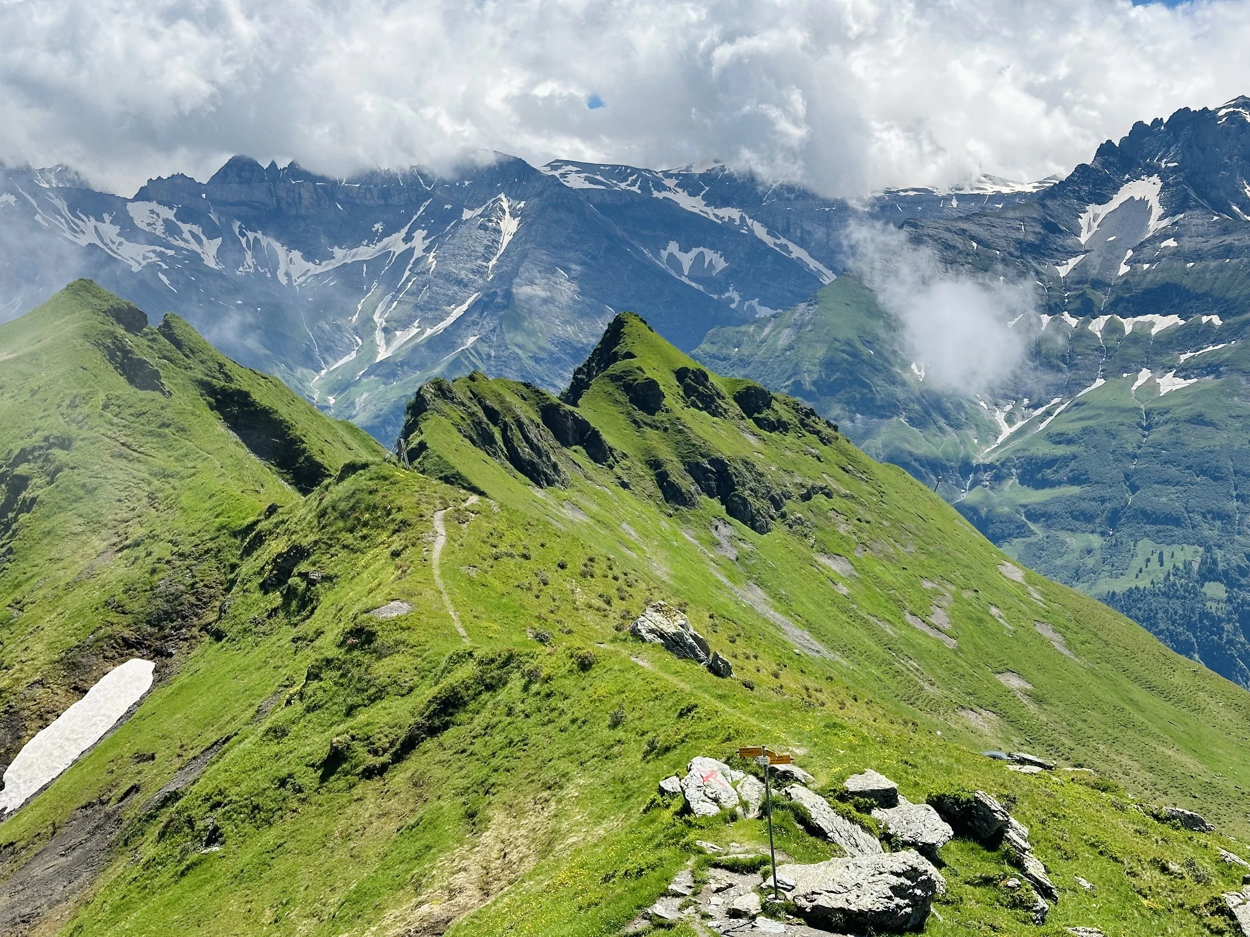
Leistchamm: St. Gallen

The Leistchamm hike is a classic hike, with a challenging yet rewarding ascent to the highest peak in the Amden region. The final ridge requires sure-footedness but leads to spectacular summit views of Lake Walensee and the surrounding Alps.
Start/End: Arvenbüel
Basic Route: Arvenbüel - Alp Looch - First - Leistchamm - Vorder Höhi - Arvenbüel
12km, 900m ascent/descent. T2